Following the Paper Trail

— posted by Susan London-Sherer

Image

 Susan London-Sherer holding copy of 1878  D.G. Beers & Co. map of Rutherford County.

Greetings from the Rutherford County Archives! Today is Wednesday, May 14, and we are experiencing our first rain day at the Rutherford County Archaeology Research Project. However, torrential rains, thunder, and lightning can not dampen our desire for knowledge. The field school students are spending the day working in the lab processing artifacts, while I am blogging from the archives.

Image


MTSU Field School Students washing artifacts.


My name is Susan London-Sherer, and I am the on-site historical archaeology/historic preservation graduate intern. While the weather may be bad outside, the archives are climate-controlled and bursting with valuable information that is pertinent to our research. A significant part of my internship involves researching the historical documentation related to the chain of ownership of the Magnolia Valley site. Over the next seven weeks, when I am not working on the survey portion of the project (digging 50-centimeter shovel test holes and screening for artifacts), I will be visiting the archives in Rutherford and Williamson Counties, as well as the county clerks’ offices, in order to trace property deeds.

Although the property is currently located in Rutherford County, the original 1833 home, built by William and Jennett McDowall, was within the bounds of Williamson County. The property became part of Rutherford County during the 1870s when that section of town was annexed into the county. Since the McDowall family, the property has been owned by the McMeekin family, the Bank of Eagleville, the Jackson family, the Bell family, the Massey family, the Crockett family, and eventually, the Tune family. I am excited to get this opportunity to follow the paper trail and see where it leads me in the coming weeks. I am even more excited to share the discovery process concerning Magnolia Valley’s past with my colleagues and the public. Please continue to follow our progress as we attempt to put the puzzle pieces of the past back together, and relay the stories of the rich history of Magnolia Valley.


Image

Original photo by http://www.gomodernvintage.com/. Modified with jigsaw app from http://bighugelabs.com/.


Aside

Today’s blog post brought to you courtesy of Nathan (MA in History). 

Sounds of shovels striking the ground and soil being sifted through screens means DAY TWO of the MTSU Archaeological Field School at Magnolia Valley has begun. Students arrived this morning refreshed after a well-deserved night of sleep; sore, but enthusiastic to learn and dig more dirt.

Dr. Peres runs the field school as “on-the-job” training. As she told us earlier, “I’m not concerned with your comfort, that is your responsibility. I’m teaching you the skills necessary to get hired as professional archaeologists.” This sentiment, coupled with the fact our field school is certified through the Register of Professional Archaeologists, means we will be prepared and qualified for any job we are hired on. 

Today we continued our Phase I work in Area A; a designated location where we are conducting tests to determine the site’s potential for further excavations. One group of students continued working with Tim on the geophysical survey. They even were able to operate the Ground Penetrating Radar (GPR) to collect data points. GPR lets us “see” below the surface and pick out anomalies that we will want to further investigate in the coming weeks.

The remainder of the students broke into teams of two to continue the shovel test survey we started yesterday. Shovel testing is the most commonly used survey method on professional (CRM) archaeology projects…in other words, get used to digging small round holes! This method is important in locating culturally significant materials and identifying any soil disturbances caused by humans. We completed the shovel testing in Area A by the end of the day today. In advance of that, I, along with Jesse and Joey, and one other student, put in transect lines in Area E — the next destination for our survey work.

Image


MTSU Archaeologists and students put in transect lines in Area E.


Transect lines are important for Phase I, as they provide a measured grid for organized work and allow us to record where we are working in both horizontal and vertical space. Jesse showed us how to use the compass to lay in a baseline. We then ran transect lines at 90 degree angles off the baseline, putting pin flags at 20 meter intervals. These flags mark the locations of future shovel tests.

Image

Pin flags. We are already regretting our choice of green pin flags. 


Having the opportunity to learn how to accurately lay in transect lines using low-tech methods (tape and compass) solidifies what we have learned in the classroom.

Image

Nathan helps to move the tapes for transect work in Area E.


Tomorrow we begin surveying in Area E — tall grass = high probability of ticks and chiggers. We also have a 100% chance of rain tomorrow….so Area E may have to wait until Thursday. 

Image

Opening Day 2014! (posted by Dr. Peres)

Today is our official first day of the 2014 MTSU Archaeological Field School. We had a hot start to our field season (high of 90F — nearly 15 degrees above average), but were fortunate to have a large shade tree under which to set up our field office. Our field season is seven weeks long…seven weeks seems like a really long time when you are sweating in the trenches of prehistory, but in reality, it is never enough time to accomplish all the work we might want to. We know our time is limited, and since we can’t predict when we might have days that are rained out, we wanted to hit the ground running. Last week we met for our orientation meeting (right in the middle of finals week), and yesterday the RCARP staff met at the Magnolia Valley site to plan where geophysical and subsurface survey work would take place. Today, once we arrived on site, we broke into two groups. One group worked with Tim, our geophysicist, and the others worked on subsurface survey.

We had four groups of two on the subsurface survey and decided to focus on an area that had the possibility of having some intact artifacts and deposits, but also was likely partially disturbed by the installation of a roadway and utility lines. Learning to dig round holes and screen the dirt for artifacts seems like it would be an easy task, but there are many steps to follow and data to record to ensure the accuracy of our work and that will we be able to reconstruct what we did at a later date in the lab. All of our shovel tests will be dug to at least 50 cm below surface. If we continue to find artifacts at that depth we excavate until we are 20 cm below any artifact layers. For several of the shovel tests we decided to use a bucket auger in the bottom. We were able to attain several meters in depth…no artifacts, but we did learn about the soil deposition of that specific area.

The remote sensing group consisted of four students plus Tim and one of our visiting archaeologists, Alesha. The goal of the remote sensing is to use several pieces of high-tech equipment to “see” where unusual features might be located below ground without digging. It is very similar to a CT scan used in medicine to identify abnormal objects (such as tumors or bone fractures). Both are non-invasive. Both differentiate between “normal” and “abnormal” features/objects. Both require the anomalies to be “ground-truth-ed” or investigated with more traditional methods to determine exactly what they are. Both require highly trained and skilled individuals to operate the machinery and analyze the data. In archaeology, remote sensing data allows us to refine our research design and focus our excavations on areas of highest interest. This helps to save time and money, but most importantly allows us to excavate less of a site, thus causing a lot less damage to irreplaceable cultural resources. 

Today one of the students in the remote sensing group was assigned the task of blogging about his experience. Here is an excerpt from Daniel’s day:

Within the enclosure we set up a grid consisting of 25 meter by 25 meter blocks. We then laid down nylon ropes to mark the transects where we would conducted three our survey using three types of remote sensing equipment. Considering archaeology is ultimately a destructive science, that is, when a site is excavated it is essentially destroyed, these methods eliminate a lot of unnecessary digging. Our use of this equipment took the majority of our day. This is a fairly tedious process, nevertheless, as the images began to reveal themselves, we realized the tremendous amount of data we were privy to. It is far too early to speculate on what some of the anomalies we can “see” might be (well, except for the very straight line running to the water meter — that screams water line!). For those of us just gaining experience with this technology, the image was an important one as we could clearly see areas we need to return to for further investigations.


Image

Tim DeSmet, conducting survey.

Image

MTSU Archaeological Field School student, Daniel, learning how to run the equipment.

Image

Tim DeSmet sharing some of the early data images….we are intrigued! 


We will investigate some of these anomalies this summer…stay tuned!

Meet the Archaeologists, Part II

Jesse Tune (center below) is the co-director for the Magnolia Valley excavations.

Left to right: Mike Moore (Tennessee State Archaeologist), Jesse Tune (PhD student, Texas A & M University and MTSU Alumnus), John Broster (Prehistoric Archaeologist, Tennessee Division of Archaeology) visited the MTSU MCAP Field School in May 2012.


As a native Tennessean, Jesse Tune has a deep interest in the state’s cultural resources. He graduated from MTSU with a B.S. in Anthropology (2008), American University with a M.A. in Public Anthropology (2010), and is currently a Ph.D. candidate in Anthropology at Texas A&M. To the last two years he has been the Archaeological Lab Manager at the Center for the Study of the First Americans. His research focuses on behavioral adaptations and technologies during the late Pleistocene. He has worked in supervisory positions on grant funded research projects throughout the Southeast.

Tune is an active participant in Tennessee archaeology. He regularly presents papers and posters at the annual CRITA meeting and other professional meetings throughout North America, and gives public talks through local interest groups such as the Middle Cumberland Archaeological Society and the Williamson County Historical Society. He is currently conducting long-term research in the state related to transitions in lithic technologies during the Pleistocene.

Through his involvement in numerous public archaeology projects, Tune advocates for greater awareness of cultural resources while teaching professional standards and ethical responsibility in research. He strongly believes in the value of public awareness and outreach. While working at the Topper site, in South Carolina, he led weeklong lithic analysis workshops for public volunteers. At American University he worked on educational displays for installation in public libraries. He currently serves as a graduate student mentor for undergraduate research at Texas A&M. He also coordinates volunteer participation in research projects at Texas A&M.

His dissertation research focuses on lithic technology and behavioral adaptations related to the Pleistocene-Holocene transition in the Southeastern United States. He is studying the evolution of biface technology throughout the Clovis-Cumberland-Dalton succession to investigate the potential effects of ecological change and colonization processes on technology and behavioral adaptations.


Archaeology Field School Toolkit — recommendations for newbies

Dr. Peres has started an Archaeology Field School Toolkit Listmania on Amazon. Some of these are required for the students in the MTSU Archaeology Field School (sunscreen!), and some are tried & true.

You can see the full list here:  Archaeology Field School Toolkit


What recommendations do you have for students just starting out in archaeology (and on a limited budget)? Not limited to equipment, advice, tips, and tricks are all welcome (as long as they are legal, safe, and sane). Post your recs/advice in the comments!

RPA-7….it’s a good thing

The MTSU Archaeological Field School is the only field school in Tennessee currently certified by the Register of Professional Archaeologists (and only one of 16 in the US and 1 international). The designation of RPA-7 means the class meets for 35 days/7weeks, and those are full 8 hour days!

What does it take to be a certified field school? Glad you asked!

The field school meets a set of professional standards covering the following five areas:

    • Purpose. The field school must have both an explicit research design and an explicit curriculum design that integrates research with student education.
    • Personnel. The Director or Principal Investigator of the field school must be RPA- certified.
    • Operational Procedure. The field school must include formal instruction on field techniques including excavation, survey, and laboratory work.
    • Field Procedure. The field school must include proper data recovery and recording techniques.
    • Sponsor. The sponsoring institution must provide appropriate resources for laboratory work, curation, and publication/distribution of the research results.

You can read the in-depth guidelines here.

How does the RPA know that the field school meets the above criteria? There is an application process, of course!

For the educational component: Dr. Peres submitted a 22 page course syllabus detailing the course objectives, expectations for students, and daily and weekly schedules.

For the research component: Dr. Peres submitted a 10 page (single-spaced) research design which detailed the objectives of RCARP and why we specifically are working at Magnolia Valley in 2014.

What does RPA-7 mean for the students?

This designation immediately signifies to prospective employers that the field school was 8 hrs day/7 weeks (the minimum for certification is 4 weeks).

The Project Director is RPA certified (and thus qualified to train students and conduct archaeological research).

A set of standard professional methods for survey, excavation, data recordation, and lab methods were taught throughout the course.

After students have successfully completed the field school this summer they will receive a certificate attesting to this achievement.


Meet our Historic Preservation/Historical Archaeology Graduate Intern


WSusane are very excited to have Susan London-Sherer join our team as the Historic Preservation/Historical Archaeology Intern. Susan received Bachelor of Science in Anthropology from MTSU in 2012. She is currently a candidate for a Master of Arts degree in Public History at MTSU (expected graduation 2015).  As the RCARP Intern this summer she will conduct archival research on two of our featured sites (Magnolia Valley and Black Cat Cave). She will help to coordinate and lead excavations pertaining to the historic component at Magnolia Valley, and will hopefully find a topic for her MA thesis.

Welcome Aboard Susan!


Meet the Field Assistants

The MTSU Archaeological Field School at Magnolia Valley has two resident field assistants, Kate McKinney and Joey Keasler. Both have completed a previous MTSU Archaeological Field School and have experience on numerous field and lab projects. Learn more about Kate and Joey here.


Kate McKinney at Glass Mounds site, 2013.

Kate McKinney at Glass Mounds site, 2013.


Kate McKinney

is a graduating Anthropology senior at MTSU. Kate’s experience working in the field consists of the 2012 MTSU Field School at the 40DV7 (directed by Dr. Peres); Glass Mounds site (directed by Aaron Deter-Wolf), Phil Stratton site (directed by Jesse Tune), and Black Cat Cave (part of the MTSU RCARP). She has training in zooarchaeology and is a paid lab assistant on several projects with Dr. Peres. In addition to her role as field assistant for the 2014 MTSU Field School, Kate will be working on a grant-funded research project analyzing the ceramics from 40DV7 and the Magnolia Valley sites. Kate will start the Applied Anthropology graduate program in the fall at Mississippi State University.


Joey Keasler

Joey Keasler, field assistant, coaches the field school students on their schnitting techniques.

Joey Keasler, field assistant, coaches the field school students on their schnitting techniques.

  • Graduated Summa Cum Laude from MTSU in December of 2013 with a B.S. in Antropology and minors in Archaeology and History.
  • Did an internship with the Tennessee Division of Archaeology in 2010 under the supervision of Aaron Deter-Wolf.
  • Worked on the Picket Chapel Archaeoloy Project in 2013 under the direction of Phillip Hodge from TDOT.
  • Worked on the Stratton Project in 2013, which was led by Jesse Tune.
  • Was a field assistant for the Middle Cumberland Archaeology Project at 40DV7 in 2012 for Dr. Tanya Peres.
  • Was a crew chief at the Castalian Springs Summer Field School (40SU14) in 2011under the direction of Dr. Kevin Smith.
  • Worked at the Coats-Hines Mastodon Site (40WM31) in 2011with Aaron Deter-Wolf and Jesse Tune.
  • Worked on the SSRG Cumberland River Emergency Archaeological Survey with Dr. Tanya Peres and Aaron Deter-Wolf following the May 2010 flood.
  • Had a paper titled “An Evaluation of the Alcohol Consumption Patterns of Tailgaters at Greenland Drive and Walnut Grove” published by Scientia et Humanitas in 2011.
  • Completed two URECA Scholar research projects while attending MTSU.
  • Received numerous scholarships.
  • Made numerous paper and poster presentations on campus, at local meetings, and national conferences.
  • A current member of the Forensic Anthropology Search and Recovery (FASR) team under the direction of Dr. Hugh Berryman.
  • Have a strong interest in Zooarchaeology, Bioarchaeology, and Battlefield Archaeology.

Meet the Archaeologists, Part I

This will be the first of several posts introducing the archaeologists that are involved with the MTSU Rutherford County Archaeology Research Program.

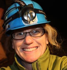
First up is Dr. Tanya M. Peres, Associate Professor of Anthropology and MTSU RCARP Director.

Dr. Tanya M. Peres


I received my BA (1995) and MA (1997) in Anthropology at Florida State University and my PhD (2001) in Anthropology from the University of Florida 2001.  Immediately following graduation in August 2001, I moved to Lexington, Kentucky to work at the University of Kentucky. While there I was  an Assistant Director of the Program for Archaeological Research and an Adjunct Assistant Professor in the Department of Anthropology at the University of Kentucky (2001-2005). I joined the Sociology and Anthropology faculty at Middle Tennessee State University in 2005, where I am currently an Associate Professor of Anthropology and Director of the Anthropology Program.

My research interests are concerned with the relationships between humans and their environments, and how these relationships impacted both the humans and other organisms around them in a variety of times and places. I have conducted extensive research on ancient environments in the southeastern United States, and at several sites in Gulf Coastal Mexico, Central Pacific Panama, and the Scottish Highlands. The goal of the 2010 NSF-funded field project that I co-directed, RAPID: Emergency Shoreline Assessment and Sampling of Archaeological Sites along the Cumberland River in Middle Tennessee, was to assess the natural and anthropogenic damage to archaeological sites along the middle Cumberland River following the May 2010 floods in Nashville, Tennessee. This grew into the MTSU Middle Cumberland Archaeology Project, which is an on-going collaboration between MTSU, the Tennessee Division of Archaeology, and several other local, state, and federal agencies, and private landowners to investigate and preserve ancient sites along the middle portion of the Cumberland River east and west of Nashville.

I have been the Project Zooarchaeologist of the Castalian Springs Archaeological Project, directed by Kevin E. Smith, since 2005. I have worked at a variety of sites across the Southeast while employed by private CRM firms, the University of Kentucky’s Program for Archaeological Research, and the National Park Service’s Southeastern Archeological Center. My publication record includes articles in Historical ArchaeologyTennessee Archaeology, and Current Research in the Pleistocene, as well as Integrating Zooarchaeology and Paleoethnobotany (co-edited with Amber VanDerwarker), Trends and Traditions in Southeastern Zooarchaeology, a guest co-edited issue of Tennessee Archaeology, numerous chapters in edited volumes, and as author or co-author of over 30 technical reports.

I have been the recipient of several research grants and awards from the Royal Society of Edinburgh International Scholar Exchange Fellowship, the Charles H. Fairbanks Award (University of Florida), a Smithsonian Tropical Research Institute Fellowship, National Science Foundation, and the Tennessee Historical Commission. In addition to being active in research and teaching I hold, or have held, positions in the Tennessee Council for Professional Archaeology, Kentucky Organization of Professional Archaeologists, Southeastern Archaeology Conference, and Society for American Archaeology.

I consider myself a third generation southeastern zooarchaeologist. I began my zooarchaeology career in 1994 as a student of Dr. Rochelle Marrinan at Florida State University (FSU). Dr. Marrinan (or Dr. M as we all refer to her) was a student of Dr. Elizabeth Wing at the University of Florida (UF) in the 1970s. During my years at FSU (where I received both a B.A. and M.A. in Anthropology) Dr. M. mentored and taught me, and scores of other undergraduate and graduate students, the rigors of taxonomic identifications and zooarchaeological data analyses and interpretations, just as she was mentored and taught by Dr. Wing. During that first zooarchaeology course we students were assigned our very own faunal assemblage to analyze. The assemblage was excavated in the 70s at the Snow Beach Site, a Swift Creek Period shell midden site. There came a point during the 1994 zooarchaeology course when a number of us had specimens that could not be identified using the comparative collection at FSU. The only thing we could do, and I am sure lobbied hard for, was to load up in Vanna White (FSU Anthropology’s white Chevy 12 passenger van) and head to the Florida Museum of Natural History at UF.

In 1997, after receiving an M.A. in Anthropology at FSU, I followed in Dr. M.’s footsteps and moved south to Gainesville to begin work toward a doctorate in Anthropology, emphasis Zooarchaeology, guided in part by Dr. Wing. While my actual dissertation focused on a site in Panama, I never strayed far from the Southeastern US. While in Panama I applied the field and lab methods I learned at FSU and UF to my PhD research of a Preceramic coastal shell midden. When analyzing the faunal assemblage for my dissertation I relied on the Zooarchaeology comparative collection and the expertise of Dr. Wing and Dr. Richard Cooke (Smithsonian Tropical Research Institute) to identify difficult specimens. During my tenure at UF I worked at the Florida Museum of Natural History on several faunal assemblages from southeastern projects including: Aucilla River Prehistory Project (Vertebrate Paleontology Range), Everglades National Park Environmental Reconstruction (EA Range), and Snake Island Zooarchaeological Analysis (EA Range).

I worked at the University of Kentucky as a Project Director, Zooarchaeologist, and Assistant Director of the Program for Archaeological Research for several years before coming to MTSU. I am so pleased to be a part of the MTSU community — I enjoy teaching and mentoring undergraduate students, and working with my very talented and supportive colleagues. I am excited about the Rutherford County Archaeology Research Program and the potential we have to learn about the prehistory of the county we call home.