Magnolia Valley Field School: Week 6 Recap and Looking Ahead to the End

— post by Dr. Peres

I know the blog has been quiet the past few days and for that I apologize. We have finished Week 6 and are now into the home stretch! Our days on site are less about the physical nature of our work (though it is still not for the out-of-shape) and more about the intellectual side of archaeology. One of the aims of archaeological excavations is to uncover physical evidence of humans whereabouts and activities in a given area. Of course artifacts (any object made, modified, or used by humans) can tell us some of this, but what really interests archaeologists are the features (evidence of human activity that cannot be removed, such as a post hole or hearth). The remote sensing work that was completed at the site is the basis for our excavation strategy. We are targeting several areas of intense anomalies.

Week 6 was about identifying features in the floors of our excavation units as soon as possible (which is one of the reasons archaeologists dig in small controlled increments), then open up more units as necessary to expose the entire surface of any given feature. This has resulted in a total of 19 excavation units open: 16 of these are 2 meter x 2 meter squares and the remaining 3 are 1 meter x 2 meter rectangles. We have exposed a total of 8 features, most of which are large and occupy more than one excavation unit. Here is a quick summary of what we know about Features 1-5 this far.

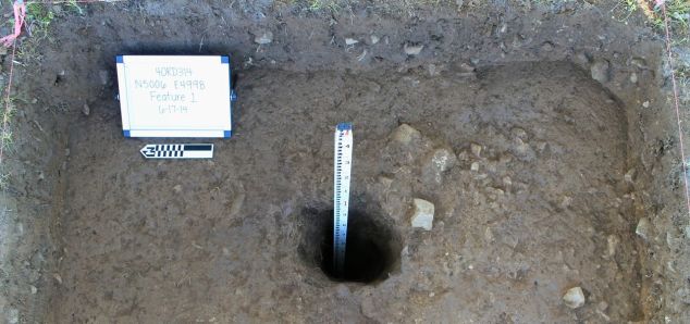
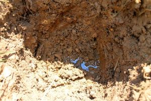
Feature 1: a posthole — not modern, maybe historic, likely older than that. This feature was first thought to be a natural tree feature, as the top outline was circular, but without distinct edges. In actuality it was the very top of the post hole, something we rarely, if ever, see in Southeastern Archaeology as most features have had the top 20-30 centimeters plowed off. Lucky for us, our site has never seen a mechanical plow. In fact, according to Susan’s research, Magnolia Valley has almost exclusively been in horse pasture. I know I have never worked on a site in the Southeastern US that did not have a deep and oftentimes destructive-to-the-site plowzone.

This feature was excavated to a depth of over 1 meter.

Feature 1, excavated.

Feature 1, excavated.


Feature 2: the historic two-track horse and wagon/buggy/carriage road. (Pictures to follow another day.)


Feature 3: a possible earth oven.


Feature 4: very large feature located to the north of Feature 3. We have opened seven 2 m x 2m and one 1 m x 2 m units to expose this feature in its entirety. We will work on documenting and excavating this during our final week on-site. We anticipate their being additional features within this one large one.


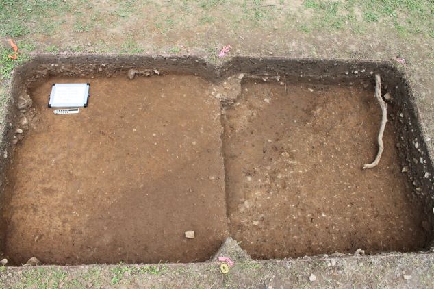
Feature 5: a long, mostly linear, slightly curving trench-like feature. We have it exposed in three 2 m x 2 m units. What is exposed is being excavated.

Plan view of Feature 5 in two consecutive units (not yet excavated).

Plan view of Feature 5 in two consecutive units (not yet excavated).


Features 6-8 are still in need of further defining before we can discuss them in any depth.


Also this week we saw a number of visitors to the site. We had a local school group of students, parents, and several teachers come and learn about archaeology with some hands-on activities. A number of MTSU faculty and alumni stopped in (and brought popsicles!) to check out our work. We love sharing what we are learning with our friends, colleagues, and anyone that is interested.

Stay tuned as we work to finish up an exciting field season at Magnolia Valley!

On the road in Allisona

— post by Susan London-Sherer, Historical Archaeology/Historic Preservation Graduate Intern

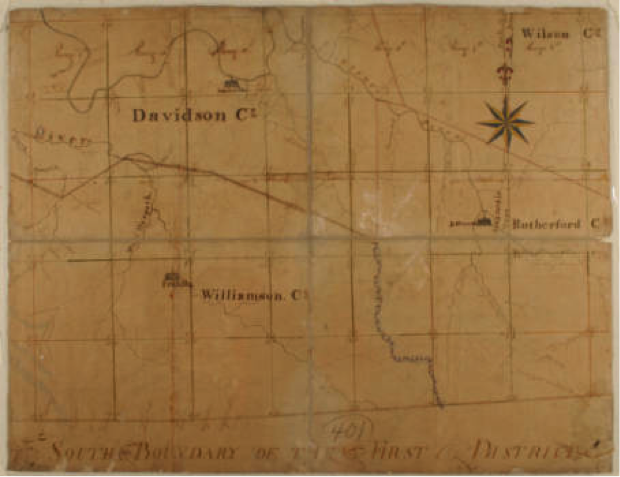
Although the timeline related to the road that we exposed in our excavation unit remains uncertain, the research that I have been doing related to it has been fascinating.  We now know that a road from James Allison’s property was ordered by the court, and that local men were appointed to build this road from 1807 to 1809.  We cannot be certain yet that the road in our unit is indeed part of this particular court-ordered road.  So, it is necessary to investigate further, to consider other avenues…take a detour, so to speak, into alternate possibilities.

If you will remember back to my last blog post, I wrote about the uniform-sized rock that my colleagues diligently shoveled and screened for days.  In researching early road construction, and in discussion with Co-Director Jesse Tune, we came up with an interesting concept that just might apply to the road in our excavation unit, and place a slightly later date on our road.

Map of the First Surveyor's District of Tennessee, circa 1807-1808 Digital Image © 2008, Tennessee State Library & Archives.

Map of the First Surveyor’s District of Tennessee, circa 1807-1808
Digital Image © 2008, Tennessee State Library & Archives.


We came across the name John Loudon McAdam, a Scottish engineer, who developed a new system for road construction in 1820.  The size and weight of each stone was the most important element of McAdam’s technique.  Men sat with small hammers and carefully broke up rocks into different sizes, which were then laid in layers with the largest on the bottom and the smallest on the top.  The largest stones, which comprised the bottom 7.9 inches of road surface, were to be no bigger than three inches in diameter.  The top two inches of the road consisted of stones no larger than .79 inches in diameter.  The road building crew was under strict supervision and the size and weight of their rocks could be checked in a variety of ways.

Sometimes road crew supervisors carried scales with them and made sure the rocks did not exceed a maximum weight of six ounces.  If no scale was available, sometimes supervisors carried metal rings that each rock had to pass through to certify its size.  The road crew also had a third option of guaranteeing the size of their rocks.  If they were able to fit the rock inside their mouths, then it was approved to go on the roadway.  McAdam’s technique also required that the men lay the road one careful shovelful at a time.

Workers break up rocks for a McAdam’s road.   This is where the term “macadam” road surface comes from. Photo courtesy of wikipidia.com

Workers break up rocks for a McAdam’s road.
This is where the term “macadam” road surface comes from.
Photo courtesy of wikipidia.com


If indeed, our road dates to a later time period, specifically after the first macadam roads were constructed in the United States in 1823, a whole new set of questions begs to be answered.  Where exactly were the early residents of Allisona going?  What kinds of places did they want, or need to visit when they traveled along this road?  What kinds of businesses developed in the region due to the construction of the road and the access it provided to the settlers?

As you can see, with each day that passes at the Magnolia Valley site, and with each new discovery that we unearth, our research questions take on new shapes and dimensions.  The more ways that we can confirm human activity on the landscape, the more significant our research becomes.  This journey began when a revealing snapshot of something that “looks like a road” was discovered in the data from our initial geophysical survey.  The road was later confirmed through the controlled excavation of a two-meter by two-meter excavation unit laid out on a grid with the same coordinates as the geophysical survey.  The historical document research revealed a contemporary road-building technique that appears to back up the description of the uniform-sized rocks that covered the road in our unit.  In this case, the detour that I took on the road to discovery led me on a quest to a precious hidden gem of knowledge.


Mama told me there would be days like this!

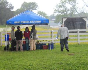
What a change from earlier in the week. Monday and Tuesday topped out in the low 90s. Today never made it out of the 50s! It was a welcome break from the heat, though we did get rained on throughout the day.

rainy


Remote sensing crew and field assistants huddle under the MTSU Blue Raider tent during one of the momentary downpours.


Magnolia Valley received well over 8 inches of rain yesterday — judging by the overflowing rain gauge on the property. We headed into the field knowing the grass would be wet and the soils saturated. We didn’t know several of our Shovel Tests would be written off due to standing water!

water in the hole

 The survey crew spent all day in Area E — a gently sloping part of the valley. We      had 26 total shovel tests to excavate there today, which isn’t that many to a     seasoned survey crew, but proved an interesting learning experience for the students. Screening wet silty loam is not a big deal, but once that loam transitions to clay, well, it is like trying to push wet play-doh through a kitchen colander. Not many artifacts were recovered from this area, which means we will likely not come back here when we start actual excavations.

Shovel Test with standing water.

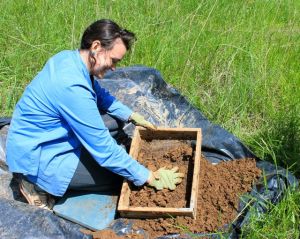
screening clay


MTSU Anthropology major Sara N., screening very wet clay soil.


Today we had our first formal visitors to the field school! Dr. Mark Byrnes, Dean of Liberal Arts, and Dr. Karen Petersen, Associate Dean of Liberal Arts at MTSU drove out from campus to check out how our first week is progressing. I was happy to report that we have completed shovel testing in two main areas of interest and collected remote sensing data on a large chunk of a high priority area.


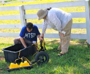
GPRMTSU Geosciences majors prepare the GPR for data collection.

Opening Day 2014! (posted by Dr. Peres)

Today is our official first day of the 2014 MTSU Archaeological Field School. We had a hot start to our field season (high of 90F — nearly 15 degrees above average), but were fortunate to have a large shade tree under which to set up our field office. Our field season is seven weeks long…seven weeks seems like a really long time when you are sweating in the trenches of prehistory, but in reality, it is never enough time to accomplish all the work we might want to. We know our time is limited, and since we can’t predict when we might have days that are rained out, we wanted to hit the ground running. Last week we met for our orientation meeting (right in the middle of finals week), and yesterday the RCARP staff met at the Magnolia Valley site to plan where geophysical and subsurface survey work would take place. Today, once we arrived on site, we broke into two groups. One group worked with Tim, our geophysicist, and the others worked on subsurface survey.

We had four groups of two on the subsurface survey and decided to focus on an area that had the possibility of having some intact artifacts and deposits, but also was likely partially disturbed by the installation of a roadway and utility lines. Learning to dig round holes and screen the dirt for artifacts seems like it would be an easy task, but there are many steps to follow and data to record to ensure the accuracy of our work and that will we be able to reconstruct what we did at a later date in the lab. All of our shovel tests will be dug to at least 50 cm below surface. If we continue to find artifacts at that depth we excavate until we are 20 cm below any artifact layers. For several of the shovel tests we decided to use a bucket auger in the bottom. We were able to attain several meters in depth…no artifacts, but we did learn about the soil deposition of that specific area.

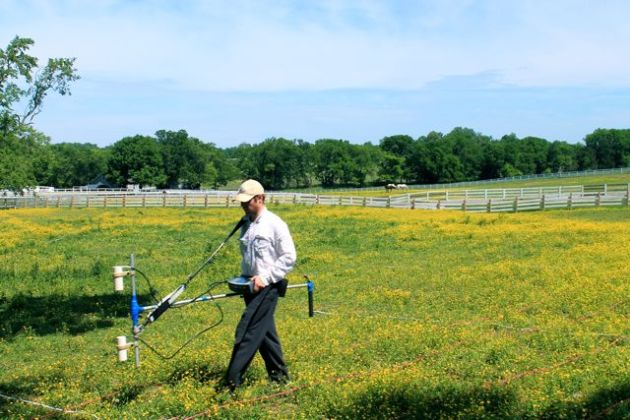
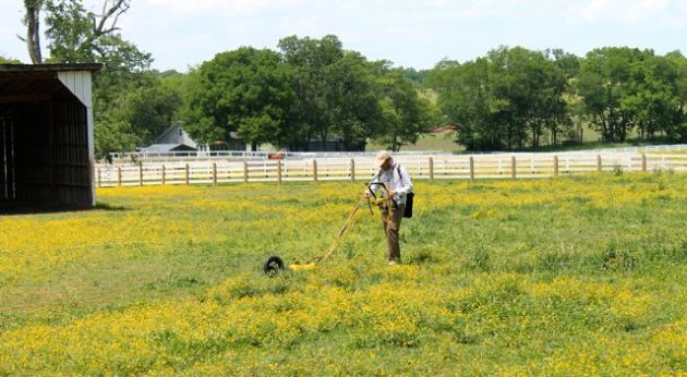
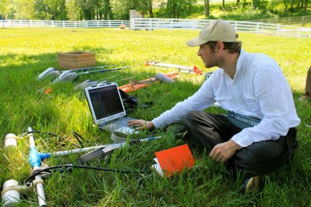
The remote sensing group consisted of four students plus Tim and one of our visiting archaeologists, Alesha. The goal of the remote sensing is to use several pieces of high-tech equipment to “see” where unusual features might be located below ground without digging. It is very similar to a CT scan used in medicine to identify abnormal objects (such as tumors or bone fractures). Both are non-invasive. Both differentiate between “normal” and “abnormal” features/objects. Both require the anomalies to be “ground-truth-ed” or investigated with more traditional methods to determine exactly what they are. Both require highly trained and skilled individuals to operate the machinery and analyze the data. In archaeology, remote sensing data allows us to refine our research design and focus our excavations on areas of highest interest. This helps to save time and money, but most importantly allows us to excavate less of a site, thus causing a lot less damage to irreplaceable cultural resources. 

Today one of the students in the remote sensing group was assigned the task of blogging about his experience. Here is an excerpt from Daniel’s day:

Within the enclosure we set up a grid consisting of 25 meter by 25 meter blocks. We then laid down nylon ropes to mark the transects where we would conducted three our survey using three types of remote sensing equipment. Considering archaeology is ultimately a destructive science, that is, when a site is excavated it is essentially destroyed, these methods eliminate a lot of unnecessary digging. Our use of this equipment took the majority of our day. This is a fairly tedious process, nevertheless, as the images began to reveal themselves, we realized the tremendous amount of data we were privy to. It is far too early to speculate on what some of the anomalies we can “see” might be (well, except for the very straight line running to the water meter — that screams water line!). For those of us just gaining experience with this technology, the image was an important one as we could clearly see areas we need to return to for further investigations.


Image

Tim DeSmet, conducting survey.

Image

MTSU Archaeological Field School student, Daniel, learning how to run the equipment.

Image

Tim DeSmet sharing some of the early data images….we are intrigued! 


We will investigate some of these anomalies this summer…stay tuned!