Magnolia Valley Field School: Week 5 Recap

— post by Dr. Peres

We have just finished Week 5 of the MTSU Field School at Magnolia Valley. This means only TWO WEEKS left before we close the site.

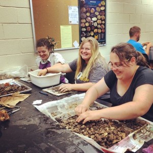
Monday was a complete wash and we spent the day in the lab washing, sorting, and bagging artifacts for analysis later this summer.

We were able to start our Tuesday at the field site and get in a few hours of work before the rain rolled in and we had to close up the site for the day. Just as we finished closing up the site and were preparing to head back to campus, we noticed the field school van had a punctured tire and was quickly going flat. Luckily, Field Assistant Joey K., was able to change the tire so we could get it back to motor pool and get a “fresh” van.  The rest of the day was spent in the MTSU Archaeology Teaching Lab. Jesse gave a mini-lecture on lithic analysis and I gave a talk on how to prepare a Curriculum Vitae (CV) — basically a long resume that details one’s education, work experience, research, publications, etc.
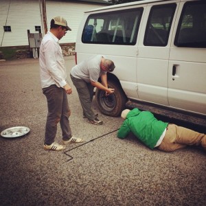
Field Assistant Joey Keasler changes the flat tire on the field school van (with help from the students). Thanks guys!
Field Assistant Joey Keasler changes the flat tire on the field school van (with help from the students). Thanks guys!

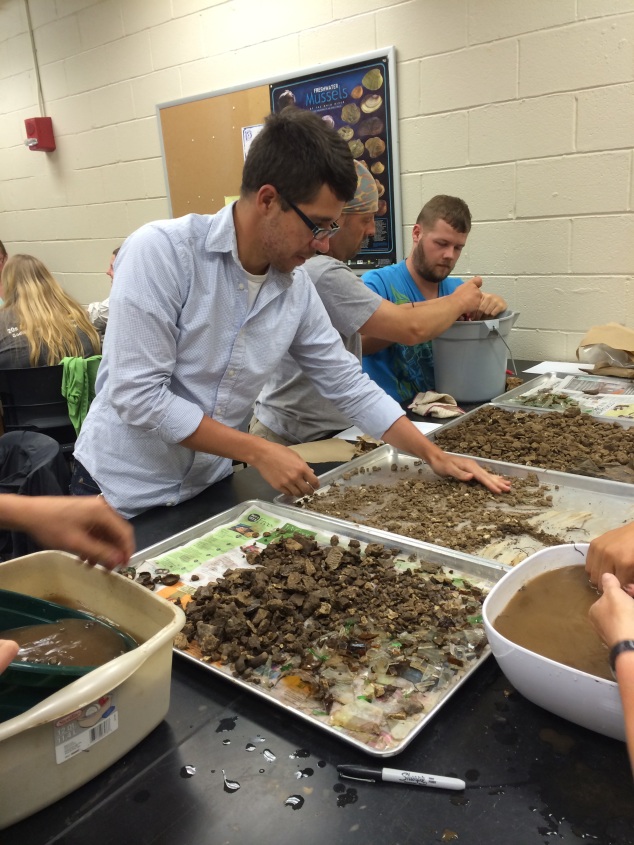
Artifact washing in the MTSU Archaeology Lab (Nathan Allison in the foreground, Josh Bicknell in the background; hands belong to various students who wish to remain anonymous).

Artifact washing in the MTSU Archaeology Lab (Nathan Allison in the foreground, Josh Bicknell in the background; hands belong to various students who wish to remain anonymous).


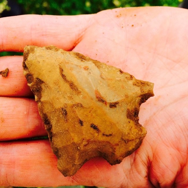
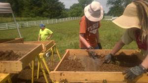
Finally, Wednesday morning arrived, sunny and mild. Everyone was ready to be on-site and move more dirt! We are all in the groove of the daily morning routine of uncovering the units and setting up the equipment in the mornings, schnitting, troweling, filling out paperwork, and screening for artifacts. Everyone knows what an artifact is — any object made, modified, or used by humans.

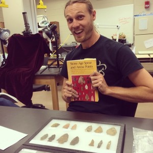
Obvious artifact: stemmed spear point made from chert.

Obvious artifact: stemmed spear point made from chert.


This week we introduced the students to the art form of feature identification. A feature is a non-moveable area that indicates human activity — such as a hearth, building wall trench, or storage pit.  Features are some of the most important things we identify in the field and why we excavate in a controlled scientific manner. Identifying features is a bit of an art form  and involves a lot of standing back and studying the soils exposed in the excavation units to determine changes in colors/textures/inclusions. Sometimes these changes are flick-you-on-the-forehead-obvious; other times it takes the trained eye of a seasoned archaeologist to tease them out.
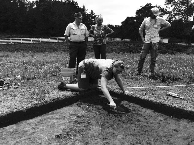
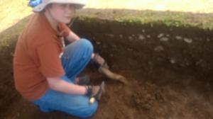
Jessica O. trowels the floor of this unit to expose Feature 6.

Jessica O. trowels the floor of this unit to expose Feature 6. The unit directly to the west (the right in the photo) will be opened next to capture more of the feature. 

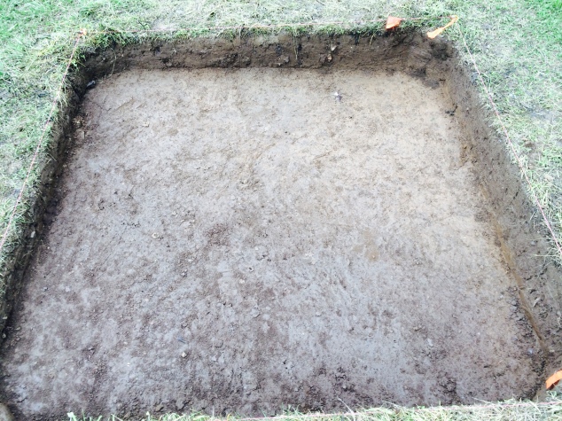
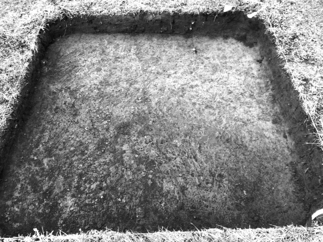
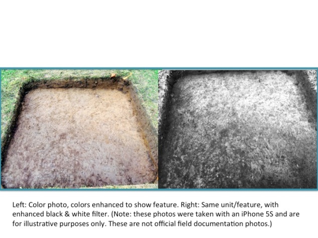
Can you spy the feature (Feature 4) in this color photo? (Scroll down to the next picture to see the unit in black & white.)

Feature 4, color photo (not an official photo for curation purposes).

Feature 4, color photo (not an official photo for curation purposes).


Same unit, only with a black and white filter applied (again – photo is for illustrative purposes, NOT an official curatorial photo). NOW do you see the feature? (Hint: it is dark soil on the lower 1/2 of the unit).


Feature 4, black and white filter applied.

Feature 4, black and white filter applied.


So far we have identified 5 cultural features (meaning ones created by humans) and one non-cultural feature (meaning likely remnants of where a tree or root once were). The five cultural features are in areas that we targeted specifically due to the remote sensing data Tim DeSmet generated early in the project. Over the next two weeks we will continue to expose these features by opening up adjacent units. We will then document them (by mapping the plan view and photographs) before excavating them. More on that in a later post.


Looking to see who visited us this week? Check out our Facebook page and Flickr account for photos!


Rain, Rain, Go AWAY!

Rain, Rain Go Away!

 — post by field school student, Taylor L.

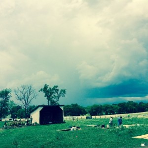
We got lucky with that storm. It passed to our west/northwest.

We got lucky with that storm. It passed to our west/northwest.

This week we have spent just as much time dodging the rain storms as excavating at Magnolia Valley! We were in the lab all day on Monday, washing and sorting artifacts from another site, Black Cat Cave.

Rain day = washing artifacts from Black Cat Cave.

Rain day = washing artifacts from Black Cat Cave.

Tuesday saw us on-site bright and early (we arrive by 7:30 am to set up all of the equipment and get going). We made the most of the morning before the storms rolled in. Even though we did not accomplish what we wanted to do, I can say my partner, Clacey and I are excited about the new unit that we opened and were able to get all the top sod off of. Through this new unit we may be able to piece the puzzle together a bit from the data we collected from remote sensing.

As the storms began to roll in we packed up and decided to relocate to the lab in Peck Hall. We had a brief delay as the MTSU van got a flat tire. Fortunately, Field Assistant Joey Keasler, was able to get it changed and us on the road before the sky really opened up!

Field Assistant Joey Keasler changes the flat tire on the field school van (with help from the students). Thanks guys!

Field Assistant Joey Keasler changes the flat tire on the field school van (with help from the students). Thanks guys!

Since we could not be outside learning hands on we had to resort to some good ole fashion learning in a class room with two mini-lectures/workshops. We had washed and sorted all of artifacts and had to wait for them to finish drying before we can re-bag. Co-director Jesse Tune gave us a crash course on lithics. After begin out in the field for the past four weeks it was nice to refresh our skills on identifying worked rock versus natural broken rock and identifying bifaces,cores and flakes.

Jesse Tune prepares to talk to the field school students about lithic analysis.

Jesse Tune prepares to talk to the field school students about lithic analysis.

Through this project we are trying to bring the past back to life, but as we lose ourselves in the past we sometimes forget about what lies for us in the future. Following Jesse’s lecture, Dr. Peres presented on the basics of the types of professional  and learning activities, outside of regular classes, we might engage in to better prepare us for life after graduation. We learned what a Curriculum Vitae (CV) is (it is a document that lists — and sometimes explains — a person’s education, research/job interests, special skills, publications, field and lab experience, etc., and is longer than a standard resume) and how to construct one. This lecture put a lot of things in perspective for me and what direction I want to go in with archaeology. Hopefully we can dodge the rain and spend the rest of the week out on the field!


Rain, visitors, and features

blog post by  Sara N.

We have now had several rain days this field season resulting in either full or partial days not spent excavating units. While we all like a break from the heat and constant sun, I think we are all ready to get back to work and see what bits of the past we can uncover. Our last full day in the field was on Friday, which was also a Friends & Colleagues Day. The rain on Thursday night meant more bailing for the RCARP crew Friday morning, leaving a few units too muddy to excavate further.

Instead we focused on one of the main goals of the project, to share the prehistory of Middle Tennessee with the public. We had four visitors at the site, including Aaron Deter-Wolf and Sarah Levithol from the TN Division of Archaeology, and MTSU Assistant Professor of Nursing Mariesa Severson and her son, future archaeologist, Will Severson.

Will S., aspiring archaeologist, learning how to trowel.

Will S., aspiring archaeologist, learning how to trowel.


Will S., learning the basics, like screening for artifacts, with field school student, Clacey.

Will S., learning the basics, like screening for artifacts, with field school student, Clacey.

They all received a tour of the area currently being excavated and a brief summary of what we’ve uncovered about the site in the past four weeks. Then they all spent a few hours getting their hands dirty! Helping screen for artifacts, carrying buckets of dirt, and “schnitting” or removing dirt from the excavation units by lightly scraping a shovel across the surface to slowly reveal any differences in the soil (technically called “features”). Friday was their  lucky day as we began to see a few of these features/soil differences. One unit has a noticeable soil change stretching diagonally across half of the 2 x 2 meter square (pictured below). Another unit has a semi-circular feature visible off of the southern wall, marked by a darker soil color and more gravel, and the outer wall of the half circle is lined with large rocks not present anywhere else in the unit.

Feature

Safety first!

— post by field school student Jared T.
The Archaeological Field School isn’t only about digging in the dirt and learning about the lives of people long gone. Much of the course is designed to train us to be professional archaeologists –which means we need to know how to act on-site and how to respond to a classmate/future co-worker that might have an emergency.

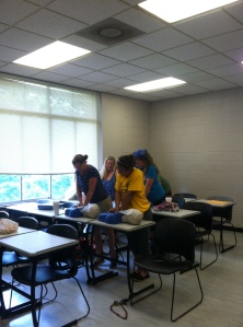
On Friday we arrived on site a full hour earlier than usual to make up for spending that afternoon on campus. Dr. Peres arranged for us to have instruction in CPR and First Aid, as there is always potential for accidents in the field, as in any work place. It is essential that we are all prepared to act should an accident happen.  We learned the kew CPR rule of 30:2;


Field school students practicing  CPR.

Field school students practicing CPR.


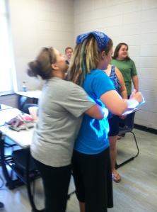
how to help a choking person;

Helping a (pretend) choking person.

Helping a (pretend) choking person.

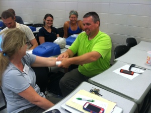
and how to wrap up a bleeding wound:

Field Assistant Joey wraps a (pretend) gash on Dr. Peres's forearm. The students are amused.

Field Assistant Joey wraps a (pretend) gash on Dr. Peres’s forearm. The students are amused.


However, we can prevent most accidents in the first place if we are prepared and use common sense. Here is a quick checklist of prevention that we follow daily:

  • drink plenty of water to stay hydrated;
  • sun block is a must (Dr. Peres actually requires sunblock use as part of the course);
  • always do a tick check when you get home;
  • handle tools  with care;  shovels should always be placed on the ground parallel to the excavation unit with the blade down.
  • do not run with a trowel in your hands.

Being safety-minded goes a long way in preventing most accidents, but we should still be prepared anyway.  The first aid class prepared us on what to do in many non-life-threatening situations, so now we know how to act if an emergency happens. It also taught us when a situation may be more than we are trained to handle, and when it is best to call in the professionals.


Opening Day 2014! (posted by Dr. Peres)

Today is our official first day of the 2014 MTSU Archaeological Field School. We had a hot start to our field season (high of 90F — nearly 15 degrees above average), but were fortunate to have a large shade tree under which to set up our field office. Our field season is seven weeks long…seven weeks seems like a really long time when you are sweating in the trenches of prehistory, but in reality, it is never enough time to accomplish all the work we might want to. We know our time is limited, and since we can’t predict when we might have days that are rained out, we wanted to hit the ground running. Last week we met for our orientation meeting (right in the middle of finals week), and yesterday the RCARP staff met at the Magnolia Valley site to plan where geophysical and subsurface survey work would take place. Today, once we arrived on site, we broke into two groups. One group worked with Tim, our geophysicist, and the others worked on subsurface survey.

We had four groups of two on the subsurface survey and decided to focus on an area that had the possibility of having some intact artifacts and deposits, but also was likely partially disturbed by the installation of a roadway and utility lines. Learning to dig round holes and screen the dirt for artifacts seems like it would be an easy task, but there are many steps to follow and data to record to ensure the accuracy of our work and that will we be able to reconstruct what we did at a later date in the lab. All of our shovel tests will be dug to at least 50 cm below surface. If we continue to find artifacts at that depth we excavate until we are 20 cm below any artifact layers. For several of the shovel tests we decided to use a bucket auger in the bottom. We were able to attain several meters in depth…no artifacts, but we did learn about the soil deposition of that specific area.

The remote sensing group consisted of four students plus Tim and one of our visiting archaeologists, Alesha. The goal of the remote sensing is to use several pieces of high-tech equipment to “see” where unusual features might be located below ground without digging. It is very similar to a CT scan used in medicine to identify abnormal objects (such as tumors or bone fractures). Both are non-invasive. Both differentiate between “normal” and “abnormal” features/objects. Both require the anomalies to be “ground-truth-ed” or investigated with more traditional methods to determine exactly what they are. Both require highly trained and skilled individuals to operate the machinery and analyze the data. In archaeology, remote sensing data allows us to refine our research design and focus our excavations on areas of highest interest. This helps to save time and money, but most importantly allows us to excavate less of a site, thus causing a lot less damage to irreplaceable cultural resources. 

Today one of the students in the remote sensing group was assigned the task of blogging about his experience. Here is an excerpt from Daniel’s day:

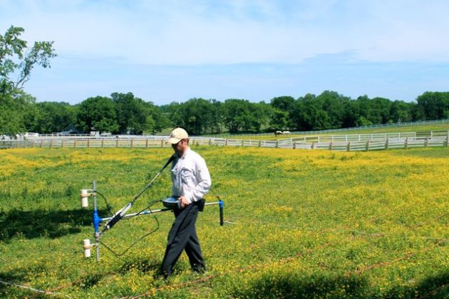
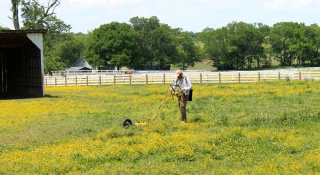
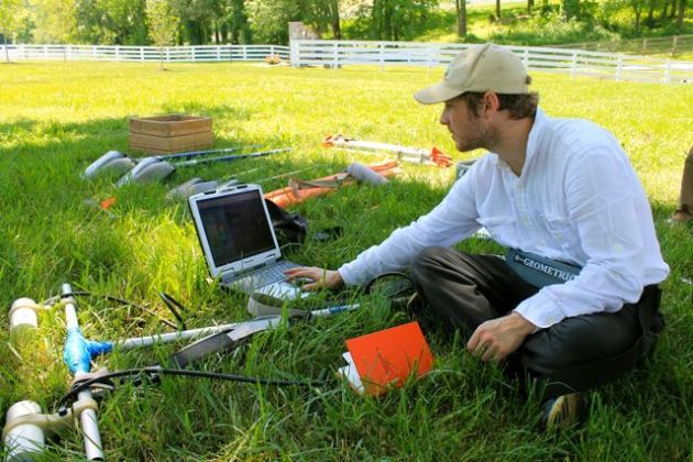
Within the enclosure we set up a grid consisting of 25 meter by 25 meter blocks. We then laid down nylon ropes to mark the transects where we would conducted three our survey using three types of remote sensing equipment. Considering archaeology is ultimately a destructive science, that is, when a site is excavated it is essentially destroyed, these methods eliminate a lot of unnecessary digging. Our use of this equipment took the majority of our day. This is a fairly tedious process, nevertheless, as the images began to reveal themselves, we realized the tremendous amount of data we were privy to. It is far too early to speculate on what some of the anomalies we can “see” might be (well, except for the very straight line running to the water meter — that screams water line!). For those of us just gaining experience with this technology, the image was an important one as we could clearly see areas we need to return to for further investigations.


Image

Tim DeSmet, conducting survey.

Image

MTSU Archaeological Field School student, Daniel, learning how to run the equipment.

Image

Tim DeSmet sharing some of the early data images….we are intrigued! 


We will investigate some of these anomalies this summer…stay tuned!

RPA-7….it’s a good thing

The MTSU Archaeological Field School is the only field school in Tennessee currently certified by the Register of Professional Archaeologists (and only one of 16 in the US and 1 international). The designation of RPA-7 means the class meets for 35 days/7weeks, and those are full 8 hour days!

What does it take to be a certified field school? Glad you asked!

The field school meets a set of professional standards covering the following five areas:

    • Purpose. The field school must have both an explicit research design and an explicit curriculum design that integrates research with student education.
    • Personnel. The Director or Principal Investigator of the field school must be RPA- certified.
    • Operational Procedure. The field school must include formal instruction on field techniques including excavation, survey, and laboratory work.
    • Field Procedure. The field school must include proper data recovery and recording techniques.
    • Sponsor. The sponsoring institution must provide appropriate resources for laboratory work, curation, and publication/distribution of the research results.

You can read the in-depth guidelines here.

How does the RPA know that the field school meets the above criteria? There is an application process, of course!

For the educational component: Dr. Peres submitted a 22 page course syllabus detailing the course objectives, expectations for students, and daily and weekly schedules.

For the research component: Dr. Peres submitted a 10 page (single-spaced) research design which detailed the objectives of RCARP and why we specifically are working at Magnolia Valley in 2014.

What does RPA-7 mean for the students?

This designation immediately signifies to prospective employers that the field school was 8 hrs day/7 weeks (the minimum for certification is 4 weeks).

The Project Director is RPA certified (and thus qualified to train students and conduct archaeological research).

A set of standard professional methods for survey, excavation, data recordation, and lab methods were taught throughout the course.

After students have successfully completed the field school this summer they will receive a certificate attesting to this achievement.